Heritage is much more than listed buildings and conservation areas. It is the larger number of nationally unlisted historic and architecturally accomplished buildings that reinforces local distinctness and sense of place.
The local list is a list of all buildings and other structures considered as having special local architectural or historic merit. They are considered to be of significance to the local community and to contribute to the environmental, social and cultural heritage of the borough.
Oldham Council, under the auspices of Greater Manchester Archaelogical Unit have embarked on a programme to identify and catalogue these heritage assets in the form of a Local List of those heritage assets not covered by the national list.
The creation of local lists will involve the application of the same criteria that is used by the Government and Historic England for buildings that are on the statutory list, but from a local perspective.
Age
- Up to 1870 most buildings which are recognisable as belonging to historic periods will Qualify.
- From 1870 to 1918 more selectivity is required because of greater numbers surviving.
- From 1918 to 1945 even greater selectivity is required.
- After 1945 only extremely good examples will be included.
Architectural quality - Builders and architects using either characteristic or unusual architectural styles or materials.
- The use of essentially local or vernacular materials and details.
- How the form of buildings relate to specific functions.
- Buildings illustrating the work of local or other architects.
- Buildings whether detached, semi-detached or in terraces may have group value based on uniformity or with formal variations .
- Buildings may contribute to the landscape or streetscape for instance by containing or enclosing attractive spaces or by responding to a particular location in terms of their setting.
Historical Interest - Rural settlement patterns including farms, hamlets and villages and the evolving pattern relating to agricultural improvement and the transformation of villages to suburbs or commuter settlements.
- The buildings may define and illustrate periods of growth in the district; and the associated form and layout of built development.
Buildings and structures representing the industrial archaeology of Saddleweorth, e.g. factories, early mills, mill ponds, weirs, water courses. - Buildings also illustrate the evolving forms of housing for different social groups especially in relation to size, layout, external spaces and decoration. e.g. council housing.
- Various buildings are associated with the evolving patterns of local administration and services and entertainment.
- The form, layout and details of farm buildings also evolved in relation to farming practices and estate policies, e.g. model farms.
- Buildings associated with particular local people of note or historic events.
Degree of alteration
The significance of alterations for interest will vary between building types and locations. Often the form and fundamental character of buildings remains recognisable despite considerable changes.
Building types
Typical building types can be recognised for a range of uses.
Houses
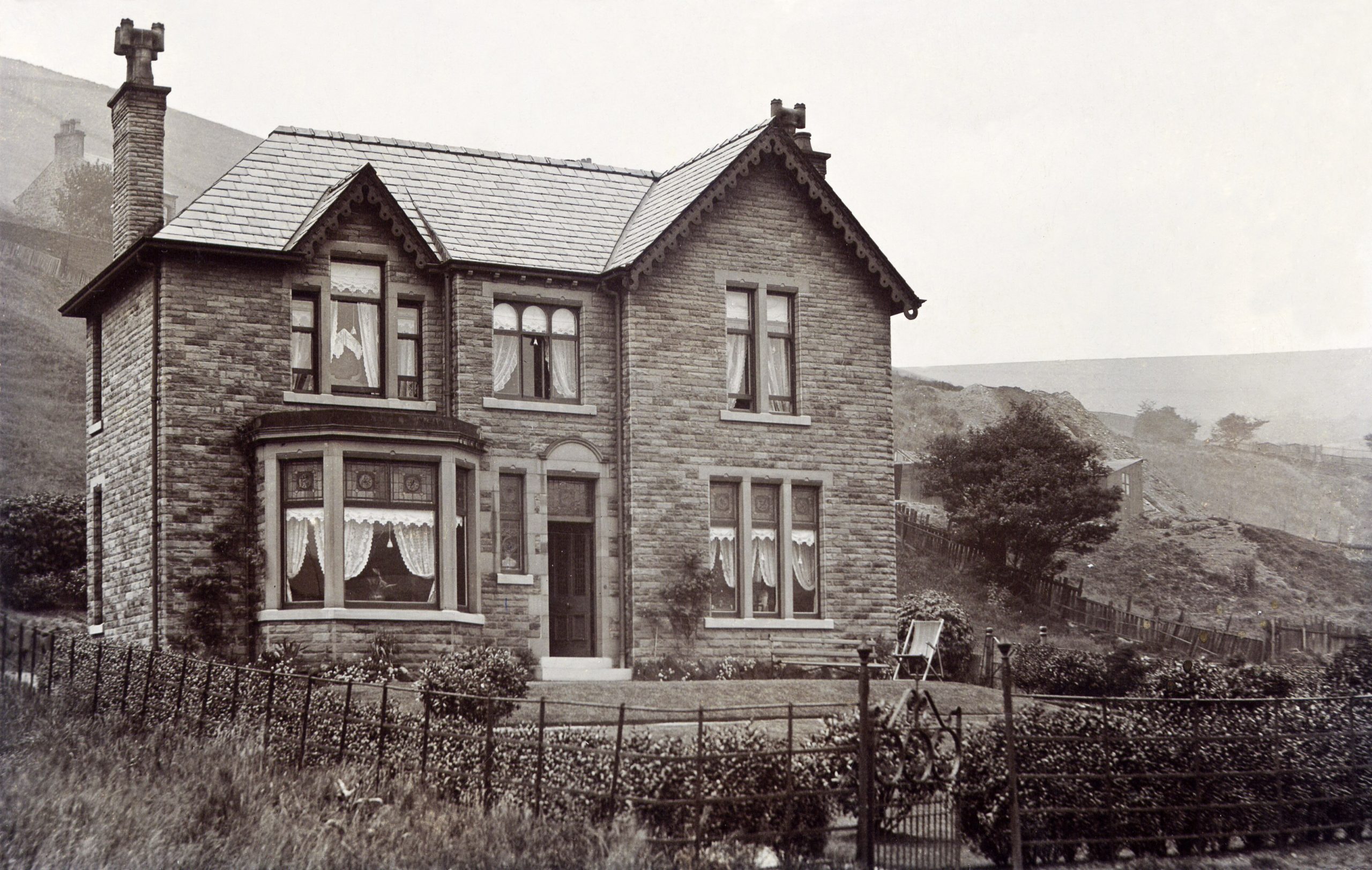
Types include rural and urban vernacular houses, architect designed detached, semi-detached and terrace houses aimed at the middle and working classes with a range of three dimensional forms and levels of architectural quality and group character.
Industrial
The areas long association with the woollen industry has left a large number of buildings reflecting the change from the domestic woollen industry to early water mills and later large factories. These chart the progress of the industrial revolution from the later years if the eighteenth century through to its decline in Saddleworth in the mid nineteenth. The construction of scribbling mills in the last two decades of the eighteenth has left a legacy of many former mill ponds, even though the mills they serviced are now long gone.
Transport
The industrial development of the district as well as the emergence of the villages was fuelled by network of turnpike road second to none. The Huddersfield Narrow Canal played a similar role until its eclipse by the railways. They have left a legacy of fine buildings, milestones, canal locks and bridges.
Farm buildings
These evolved from threshing barns, hay barns, stables, cow shippons to cart and shelter sheds as transport and technology evolved in the nineteenth century. Barn doors on laithe houses or seperate agricultural buildings tell a story of this evolution.
Shops
Shops appeared as the Saddlewrth villages were established in the eighteenth century shops. The Co-operative mvement had a major impact n most villages. Historic shop fronts are of special interest.
Religion and Education
Churches and chapels appeared in every village during the eighteenth and ninteenth centuries. Education was largely provided by Church and Chapel during the nineteenth century. Mechanics Institutes provided adult education as well as social activities.
Graveyards provide a wealth of information about social conditions in the past, social structure and mortality as well as fine examples of stone carving and calligraphy. Saddeworth has a wealth of historic church and chapel graveyards, with monuments dating as far back as the seventeenth century.
Liesure
Public Houses often trace their origins to the new turnpikes of the eighteenth century, many inns serving the stage coach traffic.
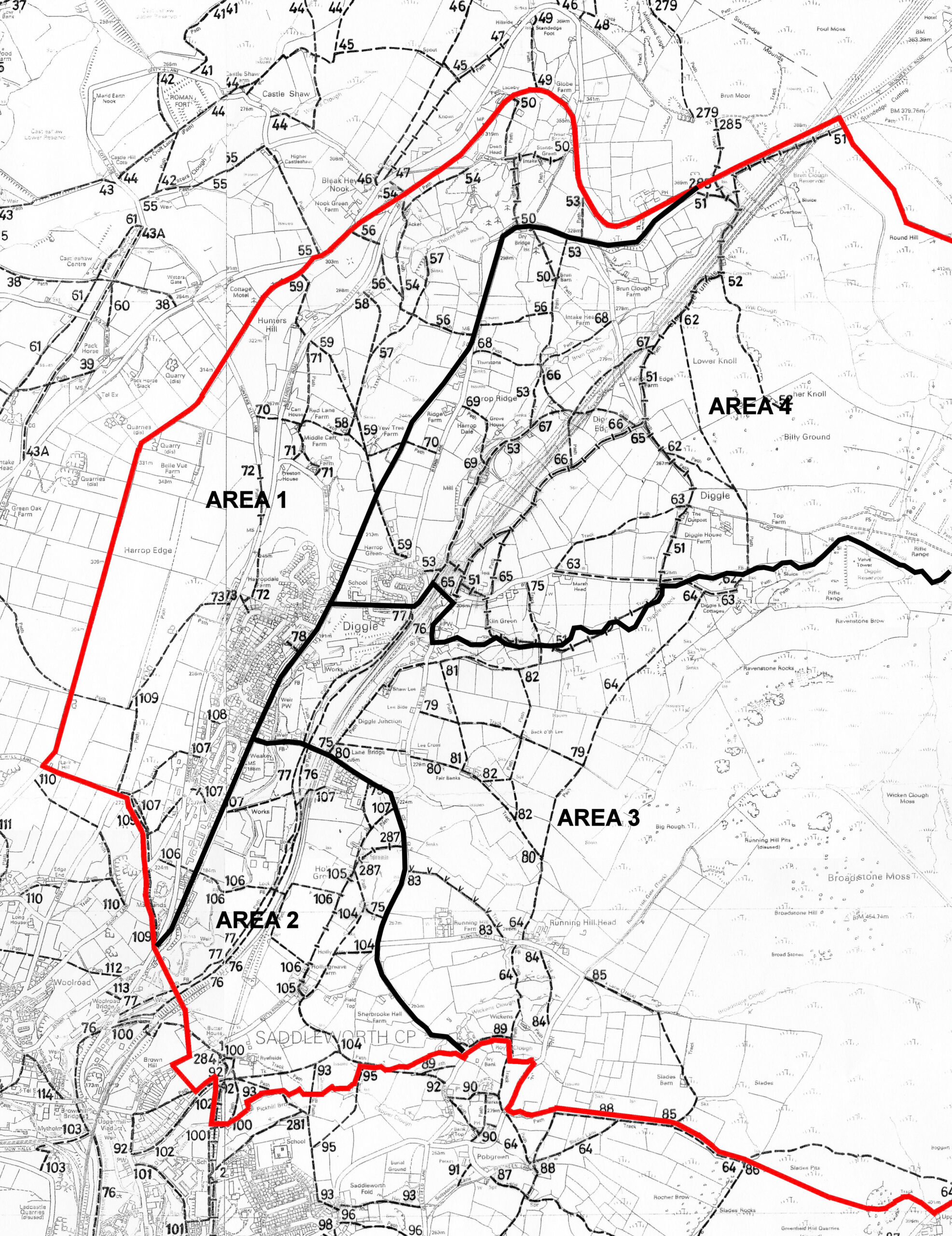
Area 1
-
1-001 Arlington House
-
1-002 43 Huddersfield Road
-
1-003 Moordale, Huddersfield Road
-
1-004 Foundry View, 109-103 Huddersfield Road
-
1-005 Council Houses, 173-189, 191-197 Huddersfield Road
-
1-006 Council Houses, Hillside Avenue
-
1-007 Council Houses, Moor Crescent
-
1-008 Telephone Box, Weakey, Huddersfield Road
-
1-009 17, 19, 21 Spurn Lane
-
1-010 Spring Hill, Spurn Lane
-
1-011 2 Spurn Lane
-
1-012 1 Spurn Lane
-
1-013 Hanging Gate Hotel, Huddersfield Rd
-
1-014 Horse Trough, Huddersfield Rd
-
1-015 267 – 281 Huddersfield Rd
-
1-016 283 – 289 Huddersfield Rd
-
1-017 291 – 309 Huddersfield Rd
-
1-018 Sunfield Estate, off Huddersfield Rd
-
1-019 Milestone, Sunfield, Standedge Rd
-
1-020 Bankfield House, Huddersfield Rd
-
1-021 Thorns Clough Mill Dam
-
1-022 Bank Gap, Carr Lane
-
1-023 Working Gas Lamp, Bank Gap, Carr Lane
-
1-024 Preston House, Standedge Road
-
1-025 Yew Tree Cottages,below Thurstons
Area 2
-
2-001 Former Church Banks Mills Ponds
-
2-002 Sherbrook Hall
-
2-003 Barn at Field Top
-
2-004 Holly Grove Cottage
-
2-005 Drinking Trough, Lower Holly Grove
-
2-006 Barn at Holly Grove
-
2-007 Weir above Wool Road Farm
-
2-008 Heys Farm, Holly Grove
-
2-009 Watercourses at Heys Farm
-
2-010 Former Diggle Co-op, Weakey
-
2-011 Milestone, Weakey
Area 3
-
3-002 Sykes Cottage, Cloughbottom
-
3-003 Water Trough at Cloughbottom
-
3-004 Runninghill Workhouse Farm Buildings
-
3-005 Runninghill Farm
-
3-006 The Cottage, Runninghill
-
3-007 Runninghill Hill Pits
-
3-008 Millstones &c, Broadstone Moor
-
3-009 Trig Point, Broadstone Moor
-
3-010 Hunting Lodge, Broadstone Moor
-
3-011 Proposed Turnpike Road to Bleakgate
-
3-012 Lee Cross Farm
-
3-013 Wrigley Mill Dam
-
3-014 Brook Dene, 162 Huddersfield Road
-
3-015 Former Liberal Club, 164. 166 Huddersfield Road
-
3-016 Former Wrigley Mill Methodist Church
-
3-017 Wrigley Mill Weir
-
3-018 Railway Signal Box, Diggle
-
3-020 Leeside
-
3-021 Ellis Mill, Huddersfield Road
-
3-022 Warth Mill, Huddersfield Road
Area 3 – continued
-
3-023 Shaw Lee House
-
3-024 Shaw Lee Cottages
-
3-025 Green Bank, Shaw Lee
-
3-026 Green Bank Cottages, Shaw Lee
-
3-027 Diggle Bridge 3-028 Diggle Mill Weir
-
3-029 Diggle Mill Dams and ponds
-
3-001 Cloughbottom
Area 4
-
4-001 Kiln Green Church
-
4-002 Beaulah House, Sam Road
-
4-003 Former Diggle Co-operative Society
-
4-004 Former Diggle Co-operative Society Extension
-
4-005 Diggle Primary School
-
4-006 2 Harrop Green Lane
-
4-007 Hillcrest, 10 Harrop Green
-
4-008 12 Harrop Green
-
4-009 14 Harrop Green
-
4-010 13 & Oak Dean Farm, Harrop Green
-
4-011 New Barn, Harrop Green
-
4-012 Kiln Butts Barn, Harrop Green
-
4-013 Road Bridge over former Railway Platform
-
4-014 Diggle Hotel
-
4-015 Diggle Barn & Coach House
-
4-016 1 Diglee
-
4-017 3 Diglee
-
4-018 6 Diglee
-
4-019 9 Diglee
-
4-020 11 Diglee
-
4-021 Former Barn, 20 Diglee
-
4-022 Water Trough, Diglee
-
4-023 Marshhead, Diglee
-
4-024 Diggle New Mill
-
4-025 Remains of Water Wheel Housing, Diggle New Mill
-
4-026 Diggle New Mill Offices
-
4-027 Diggle New Mill Bridge
-
4-028 Jeptha Statue, Diggle New Mill
-
4-029 Gateposts, Diggle New Mill
-
4-030 Canal Feed Watercourse
-
4-031 Diggle Canal Reservoir
-
4-032 Diggle House Farm, Dickens Lane
-
4-033 Diggle Top Farm, Dickens Lane
-
4-034 1, 2, 3 Harrop Court
-
4-035 Lodge Bank House, 4 Harrop Court
-
4-036 Barn, Harrop Court
-
4-037 Coach House, Harrop Court
-
4-038 Grove _Limbo_ Mill Dam
-
4-039 Grove House, Harrop Court
-
4-040 Canal Vent, Harrop Court
-
4-041 Coat Farm, Harrop Court
-
4-042 Far Diggle Edge Farm
-
4-043 3 Thurstons
-
4-044 Well, Part of Water Supply to Thurstons & Ridge
-
4-045 Site of Bakestone Pit, former Mill and Dam
-
4-046 Brun Barn, off Brun Lane
-
4-047 Brun Clough House
-
4-048 Gamekeepers Cottage, Brun Clough
-
4-049 Tunnel Vents, Brun Clough
-
4-050 Brun Clough Resrevoir